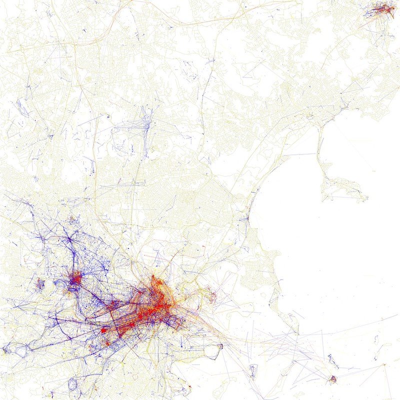
Locals and Tourists: Boston
This map takes a little explanation. Software developer Erica Fischer made this series of maps in 2010 by downloading the metadata related to photographs shared to the (then) popular photo website Flickr. If a photograph was taken more than 10 miles away from where the account was created, it was considered a tourist photograph and symbolized in red whereas photographs taken within 10 miles of the account creation were considered locals in blue. It’s a minimalist map with a ton of information. Look for Fenway Park, Cambridge and the Met. Also available for most every city on Earth.
This map takes a little explanation. Software developer Erica Fischer made this series of maps in 2010 by downloading the metadata related to photographs shared to the (then) popular photo website Flickr. If a photograph was taken more than 10 miles away from where the account was created, it was considered a tourist photograph and symbolized in red whereas photographs taken within 10 miles of the account creation were considered locals in blue. It’s a minimalist map with a ton of information. Look for Fenway Park, Cambridge and the Met. Also available for most every city on Earth.
This map takes a little explanation. Software developer Erica Fischer made this series of maps in 2010 by downloading the metadata related to photographs shared to the (then) popular photo website Flickr. If a photograph was taken more than 10 miles away from where the account was created, it was considered a tourist photograph and symbolized in red whereas photographs taken within 10 miles of the account creation were considered locals in blue. It’s a minimalist map with a ton of information. Look for Fenway Park, Cambridge and the Met. Also available for most every city on Earth.