 Image 1 of 1
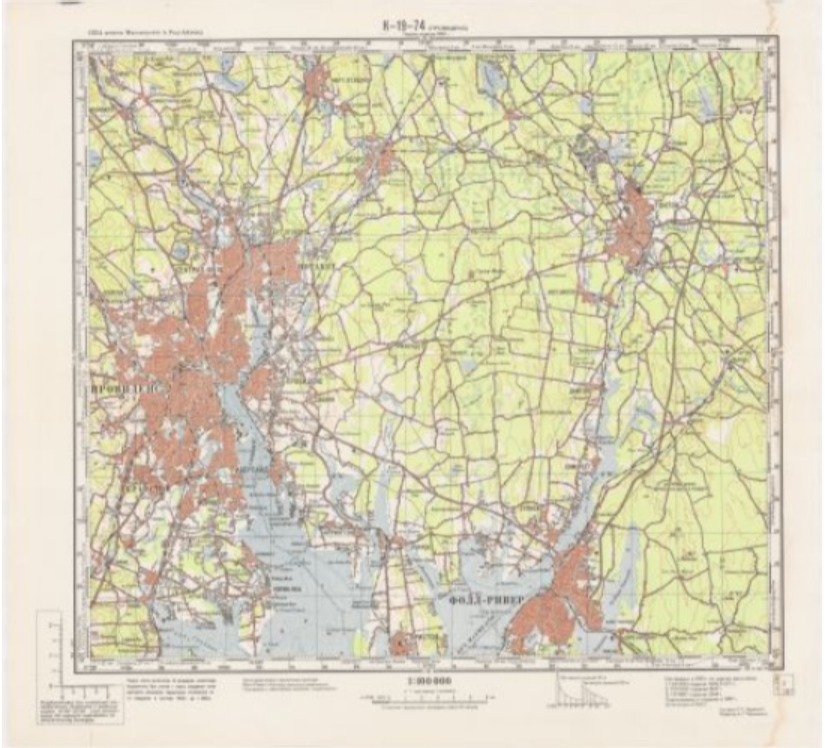
Have you read The Red Atlas? The book by John Davies and Alexander Kent? It tells a bizarre story about how the Soviet Union spent decades making intricate and precise maps of the world using an alarmingly large network of spies on the ground. They’re some of the finest maps made during the 20th century and they’re also still very much illegal in Russia. It’s a story of espionage, Cold Warriors and the most literal illustration of the phrase “Knowledge is Power” that there ever has been. Now high quality reproductions of these maps are available in the United States exclusively through The Map Center.
IMPORTANT PURCHASING INSTRUCTIONS:
Browse the Red Atlas’ catalog and take note of the map number(s) of the maps you’d like.
When you have determined which maps you’d like, order Topographic or City Plan maps from this page as desired.
Send an email info@mapcenter.com citing your order number and the map number(s) so I can get you exactly what you’re after.
Topographic maps are roughly 22”x22” and depict regions
City Plans are closer to 35”x 50” and show more detail of streets and urban environments
Notes: All maps are reproduced at original scale- please don’t purchase a Topographic Map and then request a map number corresponding to a larger City Plan or visa versa! If you do this, I will refund your order.